What is Watershed?
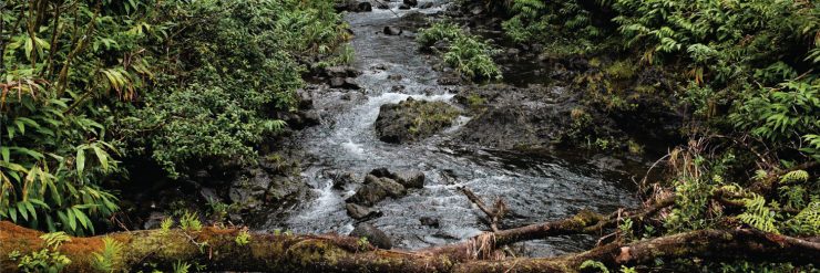
A watershed is an area of land that drains all the streams and rainfall to a common outlet such as the outflow of a reservoir, mouth of a bay, or any point along a stream channel. Watersheds can be as small as a footprint or large enough to encompass all the land that drains water into rivers that drain into any ocean.
Generation of Watershed by ArcMap
Procedure
The following instructions provide a workflow to create a watershed model in ArcMap using the Hydrology toolset from the Spatial Analyst toolbox.
A sample watershed has been generated by using SRTM 90m DEM by using the procedure explained below
- Run the Fill tool.
a. In Arc Catalog, navigate to Toolboxes > System Toolboxes > Spatial Analyst Tools > Hydrology > Fill.
b. Use a digital elevation model (DEM) as the ‘Input surface raster’.
c. Verify the pathname for the ‘Output surface raster’.
d. Input the Z-limit, if necessary.
e. Click OK.
Note: The Fill tool fills sinks to remove imperfections from the DEM. A Z-limit affects the result of the tool. It is recommended to state the Z-limit if the depths of the sinks are known. The Sink (Spatial Analyst) tool can be used to identify the sinks and their depths prior to using the Fill tool. When a Z-limit is not specified in the Fill tool window, all sinks, regardless of depth, are filled.
2. Run the Flow Direction tool.
a. In Arc Catalog, navigate to Toolboxes > System Toolboxes > Spatial Analyst Tools > Hydrology > Flow Direction.
b. Use the DEM output from Step 1 as the ‘Input surface raster’.
c. Verify the pathname for the ‘Output flow direction raster’.
d. Click OK.
Note: The Flow Direction tool determines the direction of flow from each cell to its steepest downslope neighbor
3. Run the Flow Accumulation tool.
a. In Arc Catalog, navigate to Toolboxes > System Toolboxes > Spatial Analyst Tools > Hydrology > Flow Accumulation.
b. Use the output raster from Step 2 as the ‘Input flow direction raster’.
c. Verify the pathname for the ‘Output accumulation raster’.
d. Click OK.
Note: The Flow Accumulation tool calculates the accumulated flow to each cell, as determined by the accumulated weight of all cells that flow into each downslope cell. For Calculating the flow accumulation please select the number of the pixel above 10000. This will include a stream order of 3 or 4 and the rest small streams will be eliminated.
4. Create a point shapefile by taking coordinates of any outflow Locations.
In Arc Catalog, navigate to Folder Connections>User folder>right click to Select new>Shape file>point>Define Projections>Add coordinate.
The Coordinate’s for this Watershed: (77.29E, 16.48N)
5. Run the Snap Pour Point tool to locate the pour points to cells of high accumulated flow.
a. In Arc Catalog, navigate to Toolboxes > System Toolboxes > Spatial Analyst Tools > Hydrology > Snap Pour Points.
b. Either input a point feature class or a raster as the ‘Input raster or feature pour point data’.
Note: Cells that are not NoData (cells with values) are considered pour points and are snapped if a raster input is used, while a point feature input specifies the locations of cells to be snapped.
c. Use the output raster from Step 3 as the ‘Input accumulation raster’.
d. Verify the pathname for the ‘Output raster’.
e. Click OK
Note: Pour points are points at which water flows out of an area, usually the outlet or re-entrant locations from the flow accumulation. The Snap Pour Point tool snaps these points to the cell of highest flow accumulation within a specified distance
6. Run the Watershed tool.
a. In Arc Catalog, navigate to Toolboxes > System Toolboxes > Spatial Analyst Tools > Hydrology > Watershed.
b. Use the output raster from Step 2 as the ‘Input flow direction raster’.
c. Use the output from Step 4 as the ‘Input raster or feature pour point data’.
d. Verify the pathname for the ‘Output raster’.
e. Click OK.
7. Run the ‘Raster to Polygon’ tool to create polygon features from the watershed raster.
a. In Arc Catalog, navigate to Toolboxes > System Toolboxes > Conversion Tools > From Raster > Raster to Polygon.
b. Use the output from Step 5 as the ‘Input raster’.
c. Verify the pathname for the ‘Output polygon features’.
d. Click OK.
The above watershed was created with respect to an outlet station present in Telangana. This watershed is designed for the Krishna upper subbasin area, which includes some parts of Maharastra, Karnataka, and Telangana
Important functions of Watershed:
1. It collects water from rainfall
2. It stores water of various amounts and for different times
3. It releases water as runoff
4. It provides diverse sites for chemical reactions to take place
5. It provides a habitat for flora and fauna.
The first three functions are physical in nature and are termed hydrologic functions (Figure 8). The last two are the ecological functions. Human activities affect all the functions of a watershed. For example, when buildings and other impervious areas such as parking lots cover the ground,
infiltration decreases and most of the water runs off into collection ditches where stream channel erosion may occur. Furthermore, reduced infiltration may result in less recharge of the groundwater stored in aquifers. With both urban and agricultural land uses, chemicals such as fertilizers and pesticides can mix with rain entering the soil and may reach groundwater, causing pollution of public and private wells.
Watershed management involves three main activities:
- Rehabilitation of abandoned and misused lands that export excess sediment, chemicals, or ill-timed runoff;
- Protection of natural and sensitive areas to avoid having to rehabilitate them.
- Enhancement of water resource characteristics.
Watershed Monitoring
- Water Quality monitoring
Remote sensing tools provide spatial and temporal views of surface water quality parameters that are not readily available from in situ measurements, thus making it possible to monitor the landscape effectively and efficiently, identifying and quantifying water quality parameters and problems.
Basic Concept:
Substances in surface water can significantly change the backscattering characteristics of surface water. Remote sensing techniques depend on the ability to measure these changes in the spectral signature backscattered from water and relate these measured changes by empirical or analytical models to a water quality parameter. The optimal wavelength used to measure a water quality parameter is dependent on the substance being measured, its concentration, and the sensor characteristics.
What can be measured?
Both biological and chemical properties of suspended solids can be measured by using either multispectral or hyperspectral radiometry. Significant relationships between suspended sediments and radiance or reflectance from spectral wavebands or combinations of wavebands on satellite and aircraft sensors have been shown, using in situ studies, concluded that wavelengths between 700 and 800 nm were most useful for determining the characteristics of suspended sediments in surface water.
2. Land use land cover change monitoring.
What is meant by Land Use and Land Cover?
Land use/cover is two separate terminologies that are often used interchangeably. Land cover refers to the physical characteristics of the earth’s surface, captured in the distribution of vegetation, water, soil, and other physical features of the land, including those created solely by human activities e.g., settlements. While land-use refers to the way in which land has been used by humans and their habitat, usually with the accent on the functional role of land for economic activities. The land use/cover pattern of a region is an outcome of natural and socio-economic factors and their utilization by man in time and space.
Objective:
Information on land use/cover and possibilities for their optimal use are essential for the selection, planning, and implementation of land use schemes to meet the increasing demands for basic human needs and welfare. This information also assists in monitoring the dynamics of land use resulting from changing demands of the increasing population.
How they can be identified by Satellite Remote Sensing?
Digital change detection techniques by using multi-temporal satellite imagery helps in understanding landscape dynamics.
Different materials reflect and absorb wavelengths differently. Remote sensing utilizes this phenomenon to capture a picture of the Earth’s surface by detecting how various forms of ground cover reflect solar radiation.
3. Natural hazards monitoring
Natural hazards can be categorized into cyclones, drought, Fire, Flood, Landslides, earthquakes, and volcanoes.
What are the Natural Hazards that can be monitored by remote sensing?
Almost all Natural hazards can be monitored by using some or other parameters of Remote Sensing. But we will be mostly dealing with drought, flood and fire, and Landslide.
What is drought?
Drought is a common hydro-meteorological phenomenon and a pervasive global hazard. As our climate changes, drought events will likely become more intense and frequent.
What are Different Types of Drought?
Drought is characterized by a precipitation deficit (i.e. below average rainfall) that progresses through the hydrological cycle, starting with meteorological drought and developing into hydrological drought if conditions persist. Factors influencing the nature of drought propagation include the regional climate and local catchment characteristics, such as geology, vegetation cover and type, soils, topography, and human influence Given the complex characteristics of drought, event heterogeneity, and various propagation pathways and influences, remote sensing can provide a valuable tool in the monitoring of a range of drought-related variables.
How is drought monitored?
- Satellite-derived Climate data
- Vegetation monitoring
- Satellite-derived Evapotranspiration
- Soil moisture and groundwater estimation
Methodology for Drought Monitoring
Drought is a stochastic natural hazard that is instigated by an intense and persistent shortage of precipitation. Following an initial meteorological phenomenon, subsequent impacts are realized on agriculture and hydrology. Among the natural hazards, droughts possess certain unique features; in addition to delayed effects, droughts vary by multiple dynamic dimensions including severity and duration, which in addition to causing a pervasive and subjective network of impacts makes them difficult to characterize.
In order to manage drought, drought characterization is essential enabling both retrospective analyses (e.g., severity versus impacts analysis) and prospective planning (e.g., risk assessment). Water stress or more specifically drought assessment plays a key role in water management, especially in extreme climate conditions.
For developing composite drought index datasets used are a) Satellite-based precipitation products. b) Vegetation index derived from optical images. c) Soil moisture derived from microwave datasets. Evapotranspiration is derived by using above mentioned datasets.
What is Flood?
A flood is an overflow of water on normally dry ground. This is most commonly due to an overflowing river, a dam break, snowmelt, or heavy rainfall.
Advantages of Remote Sensing for Flood Monitoring?
Remote sensing systems on satellites and aircraft can provide much of the required information for delineating the flood-affected areas, assessing the damage, and feeding models that can predict the vulnerability to flooding of inland and coastal areas.
Both Optical and SAR (Synthetic Aperture Rader) datasets can be used for monitoring flood inundated areas on a near real-time basis. Flood extent can be mapped easily in optical images because water absorbs most of the wavelength for which the radiometric values for that region are low. Same in the case of microwave region as water shows the least backscatter values. These areas can be easily identified by visual interpretation and masked out to generate flood-inundated maps.
Monitoring of Fire by remote sensing
Remotely sensed data have been extensively used for burnt area mapping. Fires produce a significant change in the structure of the land cover area. The reflectance of vegetation and the soil properties within the burnt area are noticeable in the microwave, visible, and especially the infra-red part of the electromagnetic spectrum.
What are Landslides?
A landslide is defined as the movement of a mass of rock, debris, or earth down a slope. This can occur on slopes already on the verge of movement by rainfall, snowmelt, changes in water level, stream erosion, changes in groundwater, earthquakes, volcanic activity, disturbance by human activities, or any combination of these factors
Landslides can be mapped out by both optical and microwave datasets
Synthetic Aperture Radar (SAR) imagery is produced by reflecting radar signals off a target area and measuring the two-way travel time back to the satellite. The SAR interferometry technique uses two SAR images of the same area acquired at different times and “interferes” (differences) them, resulting in maps called interferograms that show ground-surface displacement (range change) between the two time periods.
Interferometric Synthetic Aperture Radar (InSAR) is an effective way to measure changes in land surface altitude. InSAR makes high-density measurements over large areas by using radar signals from Earth-orbiting satellites to measure changes in the land-surface altitude at high degrees of measurement resolution and spatial detail.
Landslide detection by Optical images
A large amount of Earth Observation data nowadays available and the recent advances in computing power and machine intelligence allow for complex image analysis helps in identifying landslide regions. High-resolution optical datasets along with high-resolution DEM (Digital Elevation Model) are used for identifying areas prone to sliding.
Reference:
- Shukla, S., 2004. Watersheds-Functions and Management1.
- The United States Environmental Protection Agency (USEPA), (2008). Handbook for Developing Watershed Plans to Restore and Protect Our Waters, USEPA, pp. 12–10 to 12–14.
- Das, M. M. and Saikia, M. D. (2013). Watershed Management, PHI Learning.
- https://support.esri.com/en/technical-article/000012346
- Ritchie, J.C., Zimba, P.V. and Everitt, J.H., 2003. Remote sensing techniques to assess water quality. Photogrammetric Engineering & remote sensing, 69(6), pp.695–704.
- Jerlov, N.G., 1976. Marine Optics, Elsevier, Amsterdam, The Netherlands, 194 p
- Schalles, J.F., F.R. Schiebe, P.J. Starks, and W.W. Troeger, 1997. Estimation of algal and suspended sediment loads (singly and combined) using hyperspectral sensors and integrated mesocosm experiments, Fourth International Conference on Remote Sensing for Marine and Coastal Environments, 17–19 March, Orlando, Florida (University of Michigan Press, Ann Arbor, Michigan), pp. 111–120.
- Li, H., Wang, C., Zhong, C., Su, A., Xiong, C., Wang, J. and Liu, J., 2017. Mapping urban bare land automatically from Landsat imagery with a simple index. Remote Sensing, 9(3), p.249.
- West, H., Quinn, N., and Horswell, M., 2019. Remote sensing for drought monitoring & impact assessment: Progress, past challenges and future opportunities. Remote Sensing of Environment, 232, p.111291.
- Klemas, V., 2015. Remote sensing of floods and flood-prone areas: an overview. Journal of Coastal Research, 31(4), pp.1005–1013.
- Ouled Sghaier, M., Hammami, I., Foucher, S. and Lepage, R., 2018. Flood extent mapping from time-series SAR images based on texture analysis and data fusion. Remote Sensing, 10(2), p.237.
- Leblon, B., Bourgeau-Chavez, L. and San-Miguel-Ayanz, J., 2012. Use of remote sensing in wildfire management. Sustainable development-authoritative and leading-edge content for environmental management, pp.55–82.
- Zargar, A., Sadiq, R., Naser, B. and Khan, F.I., 2011. A review of drought indices. Environmental Reviews, 19(NA), pp.333–349.
- Liu, X., Zhao, C., Zhang, Q., Peng, J., Zhu, W. and Lu, Z., 2018. Multi-temporal loess landslide inventory mapping with C-, X-and L-band SAR datasets — A case study of Heifangtai Loess Landslides, China. Remote sensing, 10(11), p.1756.
- Heleno, S., Matias, M., Pina, P. and Sousa, A.J., 2016. Semiautomated object-based classification of rain-induced landslides with VHR multispectral images on Madeira Island. Natural Hazards and Earth System Sciences, 16(4), pp.1035–1048.
Written by Sobhan Mishra, Former Remote Sensing Analyst, SatSure. The story was first published on our Medium